Depth Map
A depth map is a way to represent a 3D object using a 2D grayscale image where each pixel (u, v) in the image contains a third coordinate as its gray value.
The grayscale values of a depth map do not necessarily represent a Z metric coordinate. In the context of a laser triangulation setup, these values represent the displacement of the laser line profile, which is not the physical height of the 3D surface.
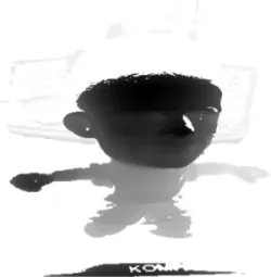
Depth map image representation in greyscale. The tint of grey corresponds to the third value, which is not necessarily its depth.
A depth map contains a gray scale image coded on 8, 16 or 32 bits per pixel.
One specific gray value, called the undefined value, is reserved for the representation of invalid pixels.
By default, this value is 0 for integer depth map types (
EDepthMap8.NET Python andEDepthMap16.NET Python).By default, this value is the lowest float value (-3.402823 e+38) for the 32 bits floating point depth map types (
EDepthMap32f.NET Python).
The calibration process aims to convert the depth map representation to real, metric 3D representations such as point clouds or meshes.
Hint
Depth maps are gray scale images where each pixel represents a displacement in the third dimension. Because of the acquisition procedure, they are usually not dimensionally correct. So, while eVision 2D image operators are compatible with depth maps, you should not use them for processes requiring precise measurements.